As above, so below: satellite surveys the Earth's faults
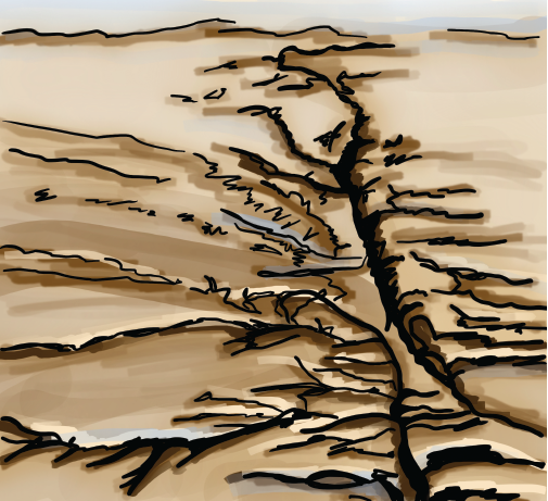
California’s seismically active network of faults gives the state both stunning coastal cliffs and an omnipresent risk of destructive earthquakes. But earthquakes aren’t the only way that faults can move. Some of California’s faults are in constant, millimeter-scale motion, due to a phenomenon known as fault creep. UC Berkeley students can see first-hand evidence of fault creep in the large crack that runs through Memorial Stadium, where the slipping surface of the Hayward fault continuously pushes the two sides of the stadium slowly in different directions.
Although fault creep happens underground, its scale is often quantified from the sky. Since 1992, geoscientists have used satellite data to observe tectonic activity. Advances in image resolution and data processing methods have allowed for increasingly precise measurements of fault creep. Using a radar imaging technique called InSAR, recent PhD graduate Yuexin Li, along with Earth and Planetary Science Professors Ronald Bürgmann and Taka’aki Taira, analyzed data from the European Space Agency’s SENTINEL-1 satellite to observe the variation in movement across the San Andreas and Calaveras faults. Through their research, Li and coauthors found an interesting pattern: where the two faults are closest, creep rates of the San Andreas fault decrease, while the Calaveras fault is more variable. Their analyses showed that fault geometry is a major factor controlling variation in fault creep rates, a finding which could help scientists better understand which parts of the state are at the greatest risk for earthquakes.
This article is part of the Fall 2023 issue.