From the field
May 10, 2020

It’s a baking-hot day in June 2019, and I’m crouched on the floor of a boat, rocking gently with the waves of the San Francisco Bay. I watch as USGS Geologist Dave Schoellhamer rubs mud between his fingers. "This has been my whole career," he says of the wet slurry. I’m here to learn from the experts who observe and measure the mud at the bottom of the San Francisco Bay. Schoellhamer’s multi-decade career was built on this research, but I’ve spent only a few days on the topic.
Our team—a collection of US Geological Survey (USGS) scientists and skippers from Santa Cruz and Sacramento—is here to study how sediments in the Bay and the processes that affect sediments change across the seasons. Sediment is a foundational component of the Bay’s ecology: a habitat for small organisms, a source of cloudy water for certain fish, and, ultimately, a building block for the marshes that support shoreline birds and plants. Unfortunately, sediment can also carry contaminants, so understanding how, when, and where the sediment moves helps scientists follow heavy metals and persistent pollutants.
Jessica Lacy, USGS oceanographer and the project lead, brought me in to help with the project, starting with what they call deployment: attaching oceanographic sensors to tripods that will sit on the bed of the Bay. These sensors will measure water currents, wave motions, sediment size, and turbidity—the muddiness of the water. After the study period is over, we’ll pull the sensors to the surface and analyze patterns in the data to understand the conditions under which mud gets swept off the bed and pushed around the Bay. Sensor preparation requires a lot of eyes to triple-check their programming, specs, and positions, pulling our team members out of their offices to share moments of close attention. Lacy corrals the action on the busy sensor-prep days, and the result is months of good data that captures slow-moving sedimentation processes.
My biggest role in the field is to orchestrate sediment sampling, which happens every week or two while the sensors sit in the water. This sampling is why I am sharing a boat with Lacy and Schoellhamer today: we send a giant scoop over the side of the boat and pull up cores of mud. We slice the cores and tuck the slices into bags, so we can bring them back to the lab and analyze them for density and grain size. By collecting these data regularly throughout the deployment, we’ll be able to see how the sediment makeup is changing with depth and time. Comparing our samples to the hydrodynamic measurements from the sensors allows us to understand the mechanisms that drive the change. Is the mud compacting, or getting fluffed-up by waves? Are the sediment transport mechanisms intense enough to move coarse grains or only very fine muds? In essence, we are asking if the Bay floor is eroding or accreting and why.
To answer these questions in more detail, we'll turn to simulations that can be validated with the field measurements we're taking now. My background is in mathematics, so fieldwork, with all of its complications, is new to me. I find it eye-opening to learn that this day on the water and the messiness of our sampling will become the standardized data to populate the surface roughness, erodibility, and sediment properties in our models. Our simulations will evolve and improve over time due to long-term monitoring work upheld by a community of committed researchers from the USGS, San Francisco Estuary Institute, San Francisco State, UC Berkeley, UC Davis, Stanford, California state agencies, and more. This network and lineage of researchers allows our data to contribute to understanding how the Bay and its muds have changed over history.
The sediment in the San Francisco Bay has been altered by many human influences, beginning with the rapid influx of people during the California Gold Rush. A 1917 USGS publication by geologist G.K. Gilbert showed how hydraulic mining—a destructive technique used during the Gold Rush—created an enormous pulse of sediment that flowed downstream from the Sierras and slowly entered the San Francisco Bay. Recent USGS research suggests that the hydraulic mining debris stuck around in Central Valley river floodplains and bayside marshes, which served as slowly eroding reservoirs of sediment—until those reservoirs ran out of sediment in the late 1990s. In the intervening time, Californian waterways were dammed, diverted, and managed, throttling delivery of sediment to the Bay. In essence, we exhausted the sediment reserve that was keeping the Bay healthy and are no longer receiving much from upstream. At the same time, the little sediments that the Bay receives has been loaded with contaminants: high levels of mercury from local mercury mines like New Almaden, polychlorinated biphenyl waste from legacy industrial activities, and radioactive mud left behind from the Bay Area’s history of nuclear production and decommissioning. The fate of the Bay’s sediments determines its continued habitability for millions of creatures, including us. We cannot undo our legacy of impact on the system, but we can change it for the better going forward. It starts with looking closely at what sediment we have.
A sense of urgency has brought our team together to track the changes in this crucial, overlooked resource. At the moment, though, the tone is relaxed. We’re quietly floating in the middle of the Bay, miles from shore. As the fog lifts and the breeze picks up, I feel happy that I’m sinking my hands into Bay mud with other people who care, happy that we can find insight into what shapes this landscape, happy that our sensors are down there, quietly monitoring. These days will become points in our data set, but the memories of time out on the water will keep me caring and coming back to the Bay and its mud.
Lukas WinklerPrins is a graduate student in environmental engineering.
Design: Mohini Bariya
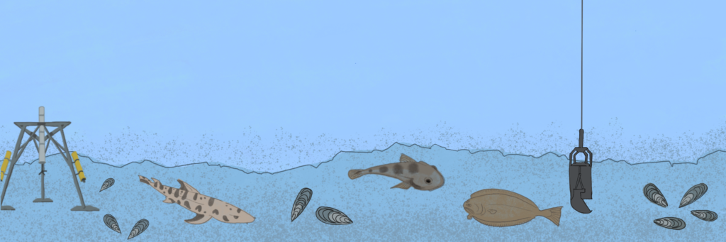 A tripod mounted with oceanographic sensors collects measurements on the Bay floor. A scoop collects mud core samples for analysis.
This article is part of the Spring 2020 issue.